
What to look for when buying a GPS: how it works, its limits and its role in taxis
What to check when buying a GPS for your car, how it calculates your position, where it fails and why a good taxi driver combines the sat nav with their knowledge of Madrid.
Published on 26 July 2016 Updated on 1 November 2026 9 min read
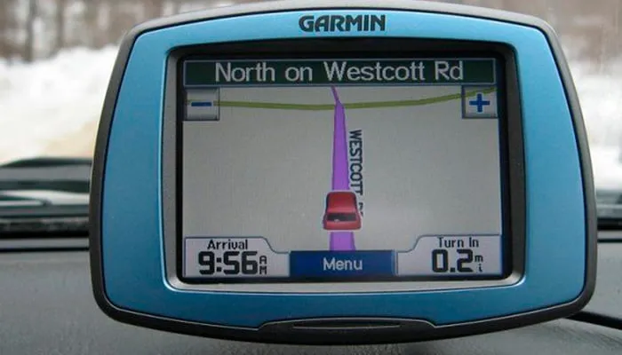
When buying a GPS for your car, look above all at five things: a good-sized screen that is readable in full sunlight, maps with updates included, real-time traffic information, voice control and hands-free so you do not touch it while driving, and a firm mount that does not block your view. Before you buy, consider whether your phone connected to the car via Android Auto or Apple CarPlay is enough, as it meets many drivers' needs today.
Whatever you choose, it is worth knowing how it works and where it gets things wrong: no sat nav is infallible. That is why professional taxi drivers use it as one more tool and rely on their knowledge of the city to decide when to follow it and when not to.
How GPS works, in a nutshell
GPS calculates your position by measuring the time it takes for the signal from several satellites to reach the receiver. Each one broadcasts its position and the exact time from its atomic clock; with the signal from at least four, the device works out latitude, longitude and altitude using a method called trilateration. The software then places that point on a digital map and calculates the route.
From the satellite to the sat nav screen
-
1
The satellites broadcast
Each satellite continuously sends a signal with its position in orbit and the time from its atomic clock.
-
2
The receiver measures the delay
The sat nav or phone notes when each signal arrives and, since it travels at the speed of light, works out how far it is from each satellite.
-
3
Trilateration
By combining the distances to three satellites it gets its position; the fourth corrects the error in the receiver's clock and provides the altitude.
-
4
Position on the map
The software places the point on the map, calculates the route to the destination and keeps recalculating it as you go.
Although we say “GPS” for everything, GPS is the United States system. There are other satellite navigation systems, collectively called GNSS: Galileo (European Union), GLONASS (Russia) and BeiDou (China). Modern phones and sat navs combine several at once, which improves accuracy among tall buildings. Many phones also use assisted GPS, which relies on the mobile network to find the satellites more quickly when you open the app.
A useful detail when buying: the satellite signal is free and does not need an internet connection. What uses data is downloading maps or receiving live traffic, which is why it matters so much whether the device comes with maps installed.
Dedicated sat nav or phone?
The first decision is whether you need a dedicated device. A phone with a navigation app offers up-to-date maps and almost real-time traffic, and if your car is compatible you can see it on the dashboard screen. A dedicated sat nav still makes sense in some cases.
| Feature | Dedicated sat nav | Phone with an app (or connected to the car) |
|---|---|---|
| Offline maps | Usually included | You have to download them in advance |
| Real-time traffic | Depending on model and service | Yes, with mobile data |
| Phone battery and data | Does not use them | Uses battery and data |
| Screen | Designed for the car | The phone's, or the car's if compatible |
| Calls and messages | With Bluetooth, depending on model | Built in |
| Cost | Buying the device | Usually no extra cost |
A dedicated sat nav can be worth it if you drive a lot in areas with poor coverage, if you travel abroad and do not want to rely on data, or if you prefer to keep your phone free for calls.
What to check before buying a GPS
Screen
A slightly larger screen lets you take in the directions at a glance and type addresses comfortably. Check that it is bright enough and does not reflect too much sunlight.
Maps and updates
A GPS with old maps is a source of errors: new streets that do not appear or one-way systems that have changed. Look for models with updates included that are easy to install, and check which countries they cover.
Real-time traffic
This is what saves the most time in the city. Some models receive it through your phone and others have their own connection; find out whether there is an extra charge.
Multi-system receiver
If the device or phone combines GPS with Galileo or other systems, it will have more satellites in view and fix your position sooner and better in narrow streets.
Voice, Bluetooth and hands-free
Voice control lets you enter the destination without touching the screen, and Bluetooth connects your phone so you can talk hands-free. These are safety features, not a luxury.
Mount and power
A mount that vibrates or falls off is a hazard. Choose a firm one and position it where it does not block your field of vision or the airbag area. 3D maps or points of interest can be useful, but they should not decide the purchase: prioritise what you will use every day.
Where every GPS falls short
In normal conditions, a car or phone receiver places your position to within a few metres, enough to know which street you are on. But there are situations in which it fails, and in Madrid they happen every day:
- Tunnels and underground car parks: the signal does not pass through earth or concrete. In the M-30 tunnels the sat nav estimates your position for a while and can get confused at the exits.
- Narrow streets with tall buildings: the signal bounces off the façades and the calculation drifts.
- Roadworks, closures and events: a last-minute closure, a demonstration or a football match may not appear on the map in time.
- Recent changes: streets that change direction, new lanes or pedestrian zones take time to be updated.
- Impractical “optimal” routes: the algorithm may send you down narrow streets to save a theoretical minute, or not know which entrance of a hotel or station is easiest to stop at with suitcases.
Sat navs make up for some of this with sensors in the vehicle or phone, but not all of it. That is where experience comes in.
GPS and taxi drivers: why they complement each other
A taxi driver who works in Madrid every day knows how each road behaves at each hour, what alternatives there are when the A-2 or the M-40 gets busy and how to reach the exact door. That spatial memory is so valuable that it has even been studied, as we explain in the extraordinary brain of taxi drivers. The sat nav gives them live traffic; they bring the judgement to know whether a detour really pays off.
| Situation | Sat nav | Experienced taxi driver |
|---|---|---|
| Real-time traffic | Detects it using data from other users | Anticipates it from the time and day |
| Tunnels | May lose the signal | Knows the exits by heart |
| Unexpected roadworks or closures | Depends on them being updated | Reacts on the spot |
| Arriving at the terminal | Takes you to the airport | Drops you at the right door and level |
The case of Barajas Airport
Barajas is a good example. T4 is separate from terminals T1, T2 and T3, with different access roads, and departures and arrivals are on different levels: a mistake at a junction can force you to go a long way round just when you have least time. Knowing which terminal you are going to is the first step; we explain it in which Barajas terminal is yours. On the way back, we check the terminal with your flight number and confirm the meeting point; that is how our airport pickup works.
Tips for passengers
If you like, follow the journey on your phone: it is useful for estimating your arrival time. If the driver suggests another route, ask them why, because there is usually a reason; and if you prefer a particular route, you can ask for it, as we explain in you can choose the route. To get to the airport you do not even have to keep an eye on traffic jams: with our fixed price by area (inside the M-30: €33; the rest on the fares by area page), the route the driver chooses does not change what you pay.
Use it safely: what the rules say
Traffic rules prohibit handling the sat nav or phone while driving, and doing so can mean a fine and the loss of points on your licence. Enter the destination before you set off, use voice control and, if you need to change something, stop somewhere safe. We go over some recent rules in what is new in traffic regulations.
And there are journeys where the best sat nav is not having to drive at all: going to the airport in a hurry, coming back in the early hours after a flight or getting around areas you do not know. For those occasions you can book your taxi to Barajas at a fixed price, from Madrid or from any town in the Madrid region.
Going to the airport? Leave the sat nav at home
Taxi drivers who know Madrid and the Barajas access roads pick you up at your door and take you to any terminal, by day or in the early hours, with a fixed price by area.
Fixed fares
Airport taxi from your area
- Interior M-30 €33
- Torrejón de Ardoz €30
- Alcobendas €33
- San Sebastián de los Reyes Pueblo €33
- Alcalá de Henares €53
- Getafe €53
- Leganés €53
- Majadahonda €53
- Las Rozas de Madrid €58
- Móstoles €63
- Alcorcón €63
- Fuenlabrada €63
Need a taxi to the airport?
Instant fixed price. No sign-up.
- Journey
- When
- Your details
We can't find it on the list.
Call or message us and we'll give you a price straight away.
Terminal · Madrid-Barajas
Your fixed price
Passengers
Suitcases
Your fixed price
Booking received!
We'll confirm your booking by phone shortly. If it's for less than 2 hours from now, please call us directly.
Reference
Your fixed price